Government Centre
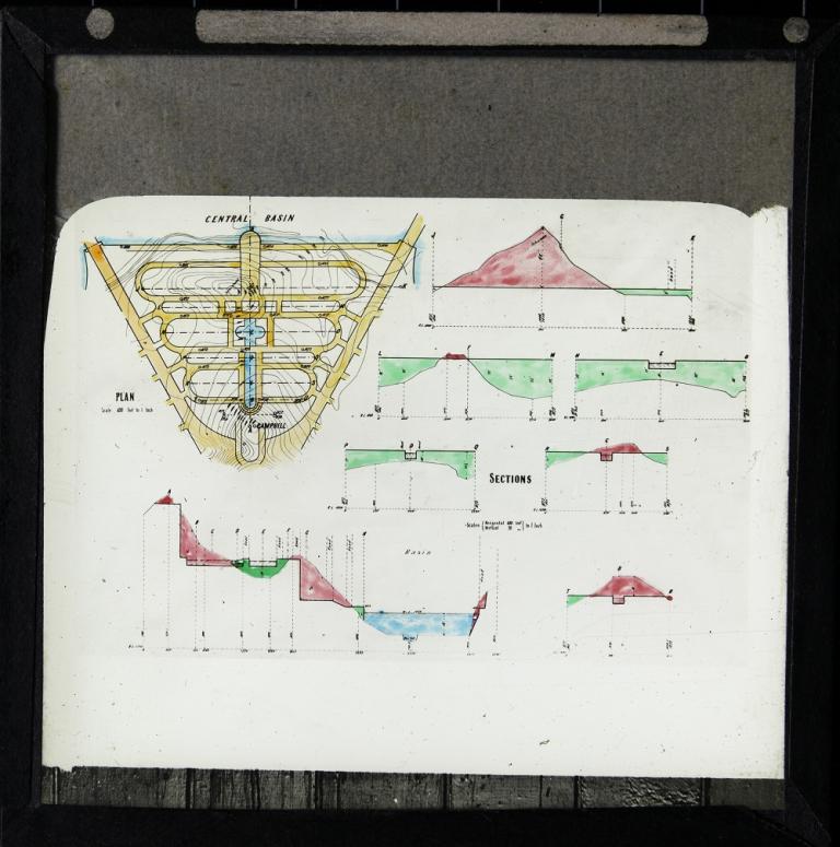
This slide shows a plan and seven section drawings for the area now known as the Parliamentary Triangle, which is situated between the Central Basin and Camp Hill.
Walter Burley Griffin called this precinct the 'Government Group', and envisaged it being filled with government departments including Trade and Customs, Home Affairs, Treasury, Defence and the Postmaster General.
The contour lines on the map indicate the gradient of the area and this is also represented in the section drawings. A water feature is visible running down the centre of the site.
The letters on the map from 'A' to 'U' indicate particular areas on the site and are also used on the section drawings. The word 'schistose' appears twice on this slide and refers to the metamorphic rocks found in this location.
The National Film and Sound Archive of Australia acknowledges Australia’s Aboriginal and Torres Strait Islander peoples as the Traditional Custodians of the land on which we work and live and gives respect to their Elders both past and present.


